
Bikepackia
EuroVelo · Norway

Arctic tundra, fjords, six routes.

Six signed EuroVelos cross Norway — the Atlantic Coast Route from Nordkapp to Bergen, the Pilgrims Route from Trondheim to the Swedish border, the Sun and East Europe routes through remote Finnmark, the North Sea Cycle Route along the southern coast and the Iron Curtain Trail stub on the Barents Sea. Wild camping is legal under Allemannsretten, Norway's statutory right to roam. Explore them, then send one straight to the planner.

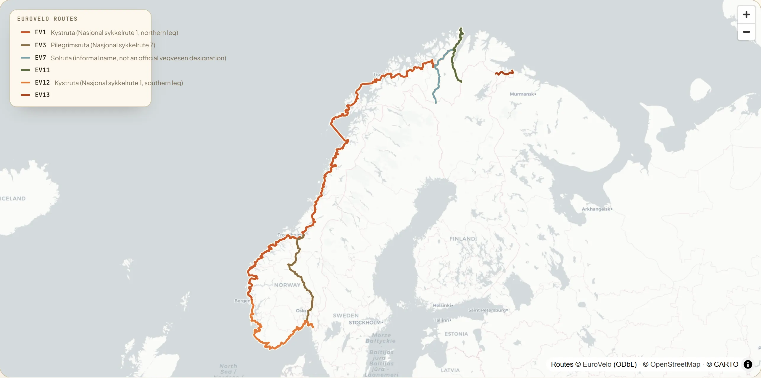
Map of Norway with six signed EuroVelo routes — EV1 the Atlantic Coast Route (Kystruta) from North Cape down the west coast to Bergen, EV3 the Pilgrims Route from Trondheim south to Halden at the Swedish border, EV7 the Sun Route from North Cape south-east through Finnmark to Neiden, EV11 the East Europe Route from North Cape south to Karigasniemi on the Finnish border, EV12 the North Sea Cycle Route from Bergen south along the coast to Svinesund, and EV13 the short Iron Curtain Trail from Grense Jakobselv on the Barents Sea to Neiden.
6
national routes
~4,600 km
EuroVelo signed
10
Nasjonale sykkelruter
Why Norway

Six EuroVelos on a wild, ferry-stitched country.

Six EuroVelos cross Norway, all mapped onto the Nasjonale sykkelruter—the ten numbered national cycle routes managed by Statens vegvesen, Norway's Public Roads Administration and EuroVelo coordination centre. About half the network is currently signposted; carry offline maps on the remote northern sections.

Routes run predominantly on low-traffic public roads; cycle paths are limited to towns. Two planning factors stand out: many long tunnels are banned to cyclists (requiring detours), and ferry crossings are essential on EV1 and EV12. The Cyclist Welcome! scheme (Syklist velkommen), run by Norway by Bike, lists accommodations with secure storage, a pump and basic tools.

The headline corridor is EV1—the Atlantic Coast Route, 2,746 km from the globe monument at Nordkapp (North Cape, 71°N) to Bergen, through Arctic Finnmark, the Lofoten Islands sea-peaks, the UNESCO-listed Geirangerfjord and the Atlantic Ocean Road.

The mapHover a route to trace it

Six EuroVelos across Norway.

Norway’s six signed EuroVelos, clipped from the official GPX tracks. Hover a line or its legend entry to trace it—EV1 down the full Atlantic coast from Nordkapp to Bergen, EV3 along the pilgrimage valley from Trondheim to Halden, EV7 and EV11 through remote Finnmark, EV12 along the southern coast to the Swedish border, and EV13’s short Barents Sea stub—then tap through to the route.

Interactive map loads as you scroll
National & regional infoBackground, not booking

The bodies behind the network.

Norway’s cycle network is coordinated by Statens vegvesen (the national roads authority and EuroVelo coordination centre), with Visit Norway promoting the routes and Norway by Bike running the Cyclist Welcome! accommodation scheme. It’s here for context and credibility. No need to leave to plan: your route and every place to stay come together in the Bikepackia planner.

The routesTap a card to learn more

Six ways across Norway.

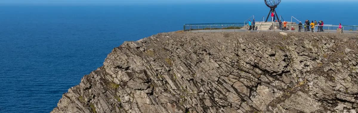
Globe monument at Nordkapp (North Cape), the start of EV1
Photo: Diego Delso (delso.photo) / Wikimedia Commons (CC BY-SA 4.0)

Atlantic Coast Route

Kystruta (Nasjonal sykkelrute 1, northern leg)NORDKAPPBERGEN

One of the world’s longest signed cycle-route segments—from the globe monument at Nordkapp (North Cape, 71°N) on Magerøya island, south and west through Arctic Finnmark tundra, the jagged sea-peaks of the Lofoten Islands and the island of Senja, then down through fjord Norway to Bergen. The route co-signs Kystruta, the northern section of Nasjonal sykkelrute 1, and is not fully waymarked in the far north—carry offline maps. Multiple ferry crossings are integral to the route. Bergen is the handoff point to EV12 (the southern Kystruta leg). Hard throughout: 2,746 km of enormous elevation gain, arctic conditions, steep fjord-side climbs and unavoidable tunnel detours.

2,746 km30–45 daysHard
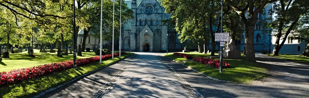
Nidaros Cathedral (Nidarosdomen) in Trondheim, northern terminus of EV3
Photo: Leonhard Lenz (GPSLeo) / Wikimedia Commons (CC0 1.0)

Pilgrims Route

Pilegrimsruta (Nasjonal sykkelrute 7)TRONDHEIMHALDEN

The historical St. Olav pilgrimage way follows the Pilegrimsruta—Nasjonal sykkelrute 7—south from Trondheim, where Nidaros Cathedral (Nidarosdomen) has been the goal of pilgrims from across Europe for nine centuries. The route threads the Gudbrandsdalen valley south through Lillehammer and Oslo before joining the eastern coast road to Fredrikstad and then Halden at the Swedish border. Moderate: narrow valleys with steep sections north of Lillehammer, otherwise rolling on quiet roads. About 640 km through Norway, passing through Oslo, the capital, and Trondheim, its third-largest city.

~640 km7–10 daysModerate
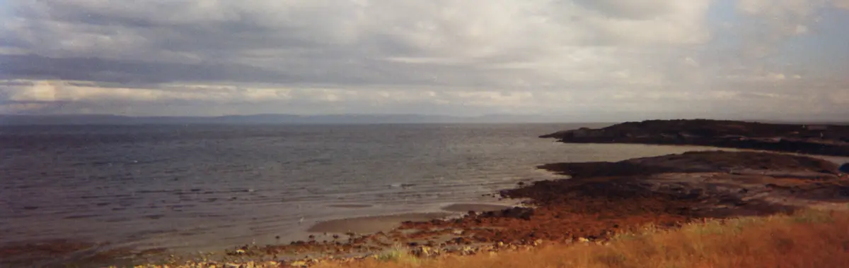
Porsangerfjorden fjord in Finnmark, on the Sun Route south of Nordkapp
Photo: A.Savin / Wikimedia Commons (CC BY-SA 3.0)

Sun Route

Solruta (informal name, not an official vegvesen designation)NORDKAPPNEIDEN

Shares its North Cape start with EV1 and EV11 but takes an inland course south through Sami territory: via Kautokeino and Karasjok through the remote Finnmark plateau before exiting Norway at the village of Neiden on the Norwegian–Finnish border. The route passes alongside the broad Porsangerfjorden and crosses open tundra with virtually no services—carry 2–3 days of food. "Solruta" is an informal name (used in trail databases but not confirmed as an official Nasjonal sykkelrute designation). Hard: extreme remoteness, Arctic weather and 3,510 m of accumulated gain on the 411 km corridor per the official Komoot GPS track.

~411 km5–8 daysHard
Finnmark plateau tundra on the East Europe Route

East Europe Route

NORDKAPPKARIGASNIEMI

The shortest Norway EuroVelo—282 km from Nordkapp south through Finnmark, following the Porsangerfjorden corridor before exiting at Karigasniemi on the Norwegian–Finnish border (a different crossing from EV7’s Neiden exit, near Karasjok). The route shares its Arctic opening with EV1 and EV7, then diverges south-east towards Finland. EV11 has no confirmed local signed name and is not designated as one of the ten Nasjonale sykkelruter. Hard: the same extreme remoteness and Arctic conditions as EV7; Komoot rates it “a hard ride requiring very good fitness.” Resupply is very sparse—plan carefully.

282 km3–5 daysHard
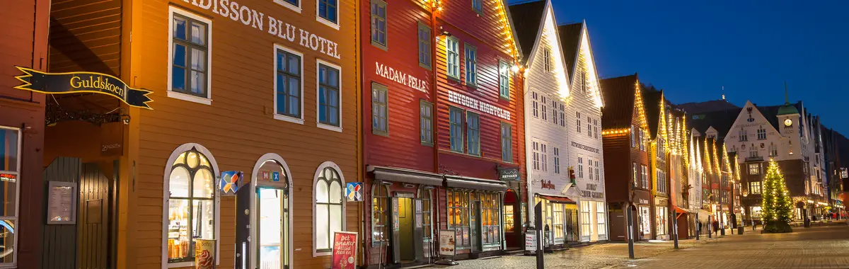
Bryggen Hanseatic wharf (UNESCO World Heritage Site), Bergen — start of EV12
Photo: Svein Magne Tunli (Smtunli) / Wikimedia Commons (CC BY-SA 4.0)

North Sea Cycle Route

Kystruta (Nasjonal sykkelrute 1, southern leg)BERGENSVINESUND

The southern pair to EV1, picking up at Bergen—where the Bryggen Hanseatic wharf (UNESCO World Heritage) lines the inner harbour—and running south and east along the coast to the Swedish border at Svinesund. The route co-signs the southern section of Kystruta (Nasjonal sykkelrute 1), with sub-sections the riders know as the North Sea Cycle Route (Bergen–Kristiansand), the Archipelago Route Skjærgårdsruta (Kristiansand–Larvik) and the Oslofjord Route (Larvik–Svinesund). Multiple ferry crossings. Moderate to Hard: demanding elevation in the Bergen–Halden section with tonnes of short climbs, easing to more manageable terrain east of Kristiansand. About 1,000 km.

~1,000 km12–16 daysModerate to Hard
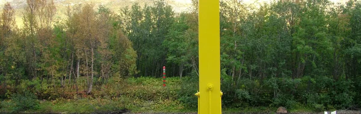
Norway–Russia border marker at Grense Jakobselv on the Barents Sea
Photo: Clemensfranz / Wikimedia Commons (CC BY 3.0)

Iron Curtain Trail

GRENSE JAKOBSELVNEIDEN

The world’s northernmost Iron Curtain Trail segment—just 102 km but with outsized historical weight. Grense Jakobselv, a fishing village on the Barents Sea, is the EV13’s global northern terminus: the spot where NATO and the Soviet Union shared their only land border during the Cold War. The route runs south-west through Kirkenes—which has a Cold War bunker museum (Grenselandmuseet)—to Neiden on the Norwegian–Finnish border, where EV13 continues into Finland. EV13 has no confirmed Norwegian local name and is not a Nasjonal sykkelrute; signage in Norway was completed in 2025. Hard: physically short but remote, Arctic-conditions riding.

~102 km1–2 daysHard
Before you rideNorway, the practical bits

What every bikepacker asks about Norway.

Is wild camping allowed in Norway?

Yes—Norway has one of Europe’s most generous access laws: Allemannsretten (the right to roam), enshrined in the Outdoor Recreation Act. On uncultivated land (forest, mountain, shore, bog) you may camp for up to two consecutive nights without the landowner’s permission, provided you pitch at least 150 metres from the nearest inhabited house or cabin. After two nights in one spot you must seek permission—except in mountains or very remote terrain. Prohibited on cultivated land (ploughed fields, meadows, gardens). Some high-visitor areas, including parts of Lofoten and Fjord Norway, now require use of designated sites in peak season, and national parks may carry additional rules.

Which season is best for bikepacking Norway?

June to August is optimal: temperatures run 16–22°C in the south and 10–15°C in Finnmark; above the Arctic Circle there is midnight sun from around 20 May to 23 July. Late June and July are peak tourist season—busier and pricier. May is quieter but mountain passes such as Sognefjellet can remain snow-blocked until late May or early June. September is possible in the south, but conditions deteriorate quickly north of Trondheim. High-altitude routes (Rallarvegen, Sognefjellet) have a narrow rideable window of late June to mid-August. Rain is possible any month, especially in western fjord Norway.

Any cycling regulations I should know?

Norway drives on the right. Helmets are not legally required for adults but are compulsory for riders under 15. Mandatory equipment: a white or yellow front light (visible 300 m), red rear light (steady or flashing), red rear reflector, white or yellow pedal reflectors (CE/E-marked), and two independent brakes. A bell is required. Reflective clothing is not legally mandatory but is required outside illuminated built-up areas in poor visibility or darkness—in practice, essential across nearly all rural and northern sections. The most critical Norway-specific rule: many long tunnels are banned to cyclists—always check before approaching one. Fines apply for missing lights, reflectors or brakes.

What should I expect as a bikepacker in Norway?

Six EuroVelos on ten numbered national routes (Nasjonale sykkelruter)—about half currently signed on the ground, so offline maps are essential. The Cyclist Welcome! label (norwaybybike.com) certifies accommodations along EV1, EV3 and EV12 with secure storage, a pump and basic tools. Bikes travel on the main train operators: Vy (Bergensbanen, 15 bike spaces), SJ Nord (Dovrebanen Oslo–Trondheim, 5 spaces; Nordlandsbanen Trondheim–Bodø, 5 spaces) and GoAhead Nordic (Sørlandsbanen and Jærbanen in the south-west)—advance reservation recommended; bike fares approximately 50% of adult non-flexible fare (max NOK 235 on Vy). Resupply is good along EV3 and the EV12 southern coast; extremely sparse in Finnmark (EV7, EV11, EV13)—carry 2–3 days of food. Wild camping under Allemannsretten is both legal and a practical norm for bikepackers.

READY WHEN YOU ARE

Pick the route. We'll plan the rest.

Drop a EuroVelo into the Bikepackia planner and turn the line on the map into rideable days — surface-aware routing, elevation, water, food and a bed every night.