
Bikepackia
EuroVelo · Switzerland

Glaciers, gorges and the Gotthard.

Four signed EuroVelos cross Switzerland — the demanding North–South Route over the Gotthard Pass to Chiasso, the Rhine Falls transit from Basel to Stein am Rhein, the great Rhine Gorge descent through Ruinaulta from Andermatt to Basel, and the Rhône valley from glacier headwaters to Geneva. All ride the Veloland Schweiz national network. Explore them, then send one straight to the planner.

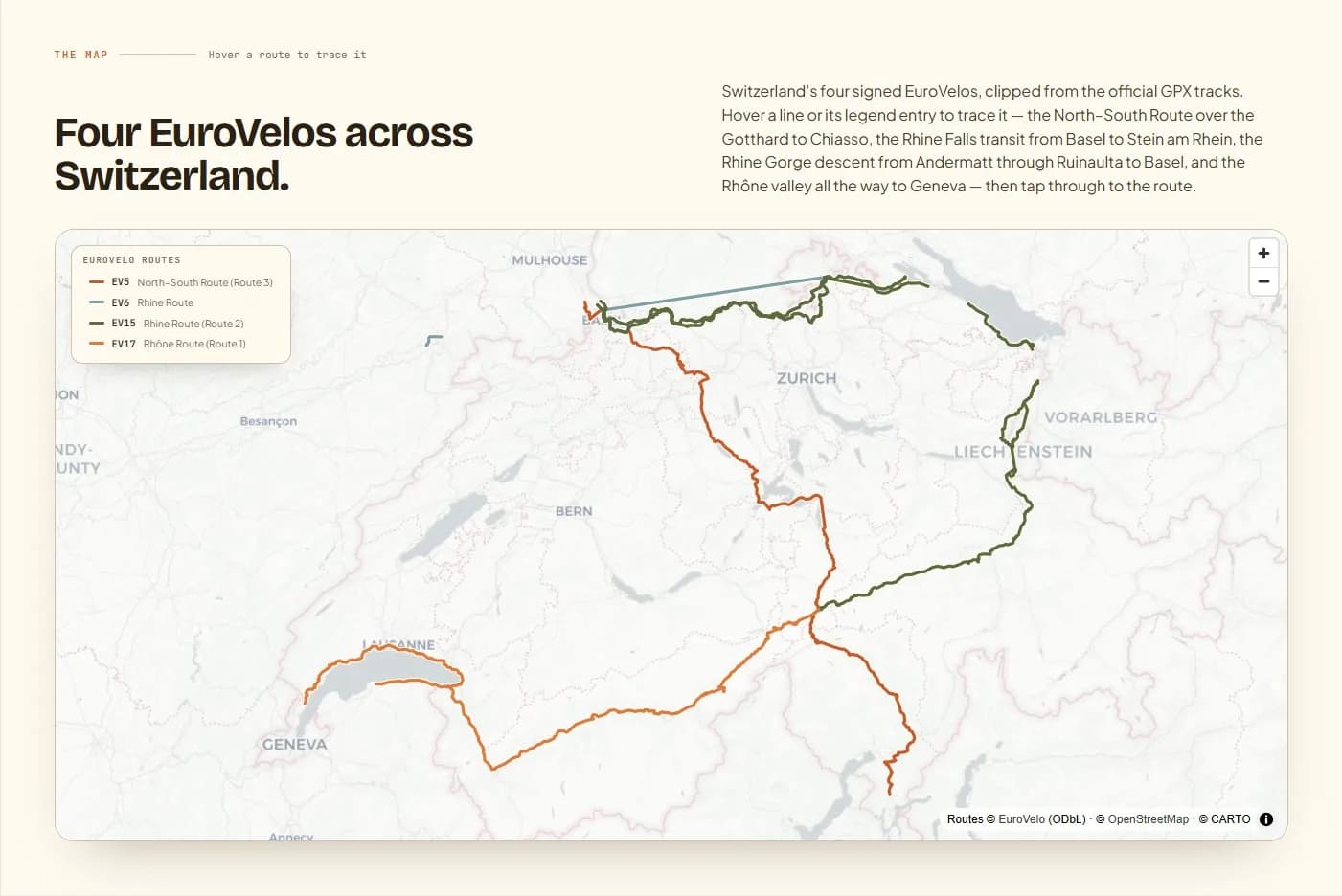
Map of Switzerland with four signed EuroVelo routes — the North–South Route (EV5) from Basel over the Gotthard Pass to Chiasso in Ticino, the short Rhine transit (EV6) from Basel to Stein am Rhein past Rhine Falls, the Rhine Cycle Route (EV15) descending from Andermatt through the Ruinaulta gorge to Basel, and the Rhône Route (EV17) from Andermatt past the Lavaux vineyard terraces to Geneva.
4
national routes
~1,290 km
EuroVelo signed
~11,000 km
national cycle network
Why Switzerland

Four EuroVelos on the Veloland national network.

Switzerland's four signed EuroVelos all map onto Veloland Schweiz, the national cycle network run by SwitzerlandMobility since 2008 — more than 11,000 km on a three-tier system (nine national routes, regional and local), all signed with red-on-white markers. EV17 follows Route 1 (the Rhône Route, Andermatt to Geneva), EV15 follows Route 2 (the Rhine Route, Andermatt to Basel, 429 km), and EV5 follows Route 3 (the North–South Route, Switzerland's most demanding signed ride over the Gotthard Pass at 2,106 m).

Infrastructure mixes river-valley cycle paths along the Rhine, Rhône and Reuss with Alpine valley roads. The cyclist-welcome label is Swiss Bike Hotels — certified by Switzerland Tourism for secure storage, a repair kit, laundry and tour information.

The scenery spans Jura limestone near Basel, the Ruinaulta gorge in Graubünden (Switzerland's Grand Canyon, 14 km of carved rock on EV15), Rhône Glacier headwaters above Andermatt, UNESCO Lavaux vineyard terraces above Lake Geneva on EV17, and the Mediterranean warmth of Lugano and Ticino at the south end of EV5.

The mapHover a route to trace it

Four EuroVelos across Switzerland.

Switzerland's four signed EuroVelos, clipped from the official GPX tracks. Hover a line or its legend entry to trace it — the North–South Route over the Gotthard to Chiasso, the Rhine Falls transit from Basel to Stein am Rhein, the Rhine Gorge descent from Andermatt through Ruinaulta to Basel, and the Rhône valley all the way to Geneva — then tap through to the route.

Interactive map loads as you scroll
National & regional infoBackground, not booking

The bodies behind the network.

Switzerland's cycle network is coordinated by SwitzerlandMobility — the statutory national body and the EuroVelo National Coordination Centre for Switzerland and Liechtenstein — with Switzerland Tourism promoting the routes and the Swiss Bike Hotels certified-accommodation scheme internationally. It's here for context and credibility. No need to leave to plan: your route and every place to stay come together in the Bikepackia planner.

The routesTap a card to learn more

Four ways across Switzerland.

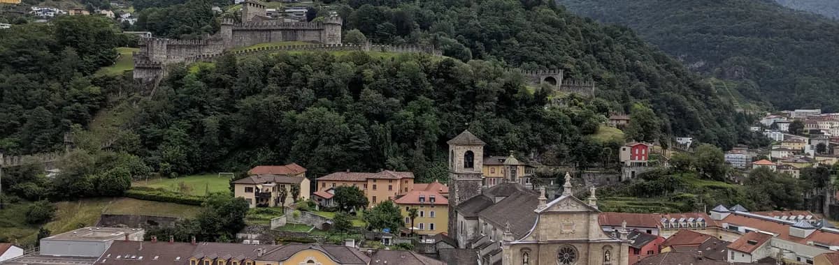
The three UNESCO castles of Bellinzona, on the North–South Route
Photo: Viktar Palstsiuk (Unomano) / Wikimedia Commons (CC BY-SA 4.0)

Via Romea (Francigena)

North–South Route (Route 3)BASELCHIASSO

Switzerland's most demanding signed ride — the North–South Route (SwitzerlandMobility Route 3) crosses the full length of the country from Basel to the Italian border at Chiasso. From the Jura hills south of Basel it descends to the Swiss Mittelland, reaches Lucerne (with its covered Chapel Bridge and the Lion Monument), then follows Lake Lucerne and the dramatic Axenstrasse gallery road to Andermatt. From Andermatt the route climbs the historic Tremola — 39 cobbled switchbacks up to the Gotthard Pass at 2,106 m, the roof of Switzerland — before descending into the Mediterranean-flavoured Ticino. The route passes the three UNESCO-listed medieval castles of Bellinzona, skirts Lago di Lugano and finishes at Chiasso on the Italian border. Hard: the Gotthard crossing is strenuous and the Tremola cobbles are demanding even unloaded. Seasonal: the Gotthard Pass road is closed from approximately early November to mid-May — plan the Alpine crossing for May through October only. EuroVelo states ~360 km across Switzerland.
~360 km5–8 daysHard
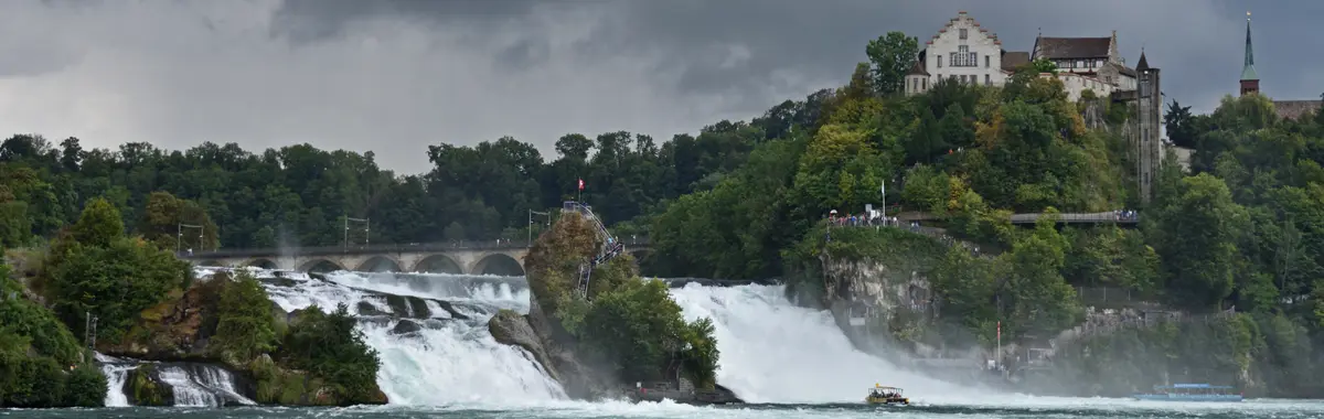
The Rhine Falls at Neuhausen am Rheinfall, Switzerland's great waterfall
Photo: Ymblanter / Wikimedia Commons (CC BY-SA 4.0)

Atlantic – Black Sea

Rhine RouteBASELSTEIN AM RHEIN

Switzerland's shortest EuroVelo — a 2–3 day Rhine valley cruise along the lower Rhine before the route leaves Swiss territory near Lake Constance. From Basel it runs east along both Rhine banks through the medieval towns of Rheinfelden, Laufenburg and Kaiserstuhl, all the way to Schaffhausen and the Rhine Falls (Rheinfall) — Europe's largest waterfall by volume, 150 m wide and 23 m high, thundering below the Munot fortress. The route then follows the vine-covered hills and frescoed facades of Stein am Rhein before crossing to Germany. Easy: flat Rhine valley throughout, excellent infrastructure on both banks. About 170 km across Switzerland.

~170 km2–3 daysEasy
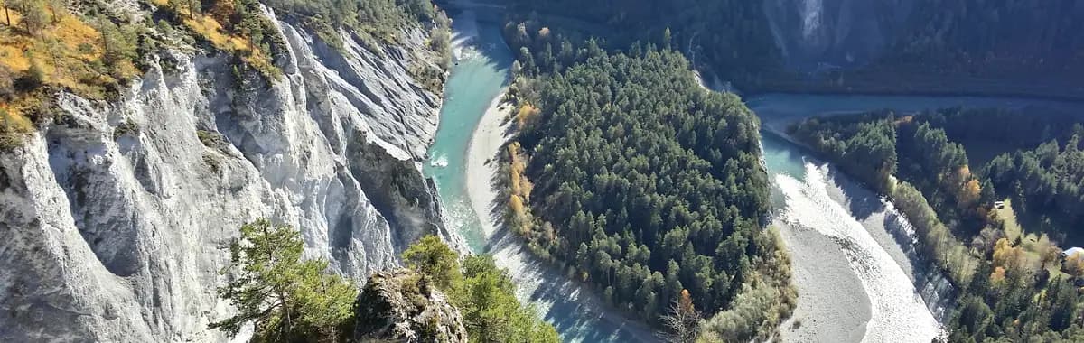
The Ruinaulta Rhine Gorge in Graubünden, on the EV15 descent
Photo: GabrielleMerk / Wikimedia Commons (CC BY-SA 4.0)

Rhine Cycle Route

Rhine Route (Route 2)ANDERMATTBASEL

Switzerland's flagship Alpine-descent ride — the Rhine Route (SwitzerlandMobility Route 2) drops from the mountains at Andermatt all the way to Basel and Germany. It opens with the stiff Oberalp Pass climb (2,044 m) — the hardest section of the whole route — before plunging into the Ruinaulta gorge in Graubünden, a 14 km canyon of sculpted grey rock sometimes called Switzerland's Grand Canyon. From there the Vorderrhein and Rhine valleys carry the route through Chur, Rorschach on Lake Constance, Schaffhausen, Rhine Falls and on to Basel. Once over the Oberalp the route is almost entirely on dedicated cycle paths alongside the river, on a long, sustained downstream gradient. Moderate overall despite the Alpine start. EuroVelo states about 429 km across Switzerland.

429 km7–10 daysModerate
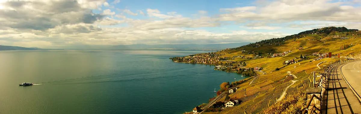
Lavaux UNESCO vineyard terraces above Lake Geneva, on the Rhône Route
Photo: Foto-Falk / Wikimedia Commons (CC BY-SA 4.0)

Rhône Cycle Route

Rhône Route (Route 1)ANDERMATTGENÈVE

The great Swiss downhill — the Rhône Route (SwitzerlandMobility Route 1) follows the Rhône from its Alpine source above Andermatt (1,437 m) all the way to Geneva and the French border. The route begins in the mountain village of Andermatt and descends through the Conches valley before sweeping through the Valais — Brig, Sierre, Sion, Martigny — the sunnier, most sheltered region of Switzerland. Past Martigny it climbs briefly to round the Dents du Midi, then follows the northern shore of Lake Geneva (Lac Léman) through Montreux, past the medieval Château de Chillon clinging to the lakeside, and along the UNESCO Lavaux wine terraces — 30 km of steep hillside vineyard above the lake — before finishing in Geneva. Mostly downhill and mostly paved. Moderate: the Alpine start requires fitness — and the optional Furka Pass prologue (15 km from Andermatt to the Rhône Glacier at Gletsch, then back down to Route 1) adds serious climbing for those who want the glacier source. EuroVelo states 332 km from Andermatt to Geneva.

332 km6–9 daysModerate
Before you rideSwitzerland, the practical bits

What every bikepacker asks about Switzerland.

Is wild camping allowed in Switzerland?

Wild camping — pitching a tent on open land below the treeline — is prohibited throughout Switzerland in all 23 cantons. Above the treeline (roughly 2,200 m), a single-night bivouac (sleeping out with a small bivi bag, ideally without a tent) is generally tolerated by tradition, with strict conditions: one night only, leave no trace, no group camping, no fire. Absolute no-go zones regardless of altitude include the Swiss National Park, all federal wildlife reserves, nature reserves, hunting reserves and private land without permission. Fines for wild camping and littering can reach CHF 10,000. Practical alternatives: around 444 registered campgrounds (typically around CHF 20 per night), the Nomady app (private-landowner pitches), and Swiss Bike Hotels listed on myswitzerland.com.

Which season is best for bikepacking Switzerland?

May to September, with June to September the warmest and most reliable — valley temperatures reach 18–28 °C in summer. May and early October are cooler (10–18 °C), quieter and still fine for the river-valley routes (EV6, the lower EV15 and EV17). The mountain passes that EV5 and EV15 cross are the key constraint: the Gotthard Pass (EV5) opens around 8 May and closes around 7 November; the Oberalp Pass (EV15) and Furka Pass (EV17 optional prologue) are generally passable from mid-June and close by late October — always check current status via the SwitzerlandMobility app or MeteoSwiss before departure. Avoid November to March: icy conditions, closed passes and short days. Afternoon thunderstorms are common in the Alps in July and August; the Ticino (EV5 south) and Valais (EV17) are warmer and sheltered, and ride well from May to September.

Any cycling regulations I should know?

A helmet is not compulsory for standard bicycles or slow e-bikes (up to 25 km/h) but is mandatory for fast e-bikes (up to 45 km/h); there is no mandatory helmet age for children on standard bikes, though it is strongly recommended. Lights and reflectors are required: a white front light and red rear light at night and in poor visibility (visible from at least 100 m), plus white front and red rear reflectors at all times. Ride on the right; use signed cycle lanes and paths where provided (they are compulsory where signed). Using audio devices that impair hearing of traffic is prohibited; riding with less than one hand on the handlebars draws a CHF 20 fine. Other indicative fines: riding through a red light CHF 60, no lights at night CHF 40–60, riding on the pavement CHF 40. A new set of e-bike-specific road signs came into force from 1 July 2025. Swiss blood-alcohol limits for cycling apply — treat the limit as 0.5 ‰ and avoid alcohol before riding.

What should I expect as a bikepacker in Switzerland?

Four signed EuroVelos mapped onto Switzerland's Veloland Schweiz national network — the most demanding (EV5 / Route 3, the Gotthard crossing), the internationally popular Rhine Gorge descent (EV15 / Route 2), the glacier-to-Geneva Rhône valley (EV17 / Route 1) and the short lower-Rhine transit to Rhine Falls (EV6). All routes use SwitzerlandMobility red-on-white signage; the SwitzerlandMobility app (iOS/Android, free to download; offline maps and GPX export with a Plus subscription) provides elevation profiles, accommodation listings, public-transport connections and live route-closure alerts. The cyclist-welcome label is Swiss Bike Hotels — properties certified by Switzerland Tourism for secure bike storage, a repair kit, drying and laundry facilities, a hearty breakfast and local tour information, listed on myswitzerland.com. Bikes on Swiss trains (SBB/CFF) require a bike day pass (CHF 15) or annual pass (CHF 260); reservations (CHF 2) are mandatory on InterCity (IC) trains from March to October and on international services year-round. Resupply is excellent in valleys and cities but thinner in high-Alpine sections — plan provisions carefully on EV5 above Andermatt and on EV15 near the Oberalp Pass.

READY WHEN YOU ARE

Pick the route. We'll plan the rest.

Drop a EuroVelo into the Bikepackia planner and turn the line on the map into rideable days — surface-aware routing, elevation, water, food and a bed every night.