Bikepackia
EuroVelo · United Kingdom

Ride Britain end to end.

Four signed EuroVelos cross Great Britain — the Atlantic Coast through the Highlands, the Capitals Route over the Welsh mountains, the short Via Romea to Dover and the North Sea Route all the way to Shetland. All ride the National Cycle Network. Explore them, then send one straight to the planner.

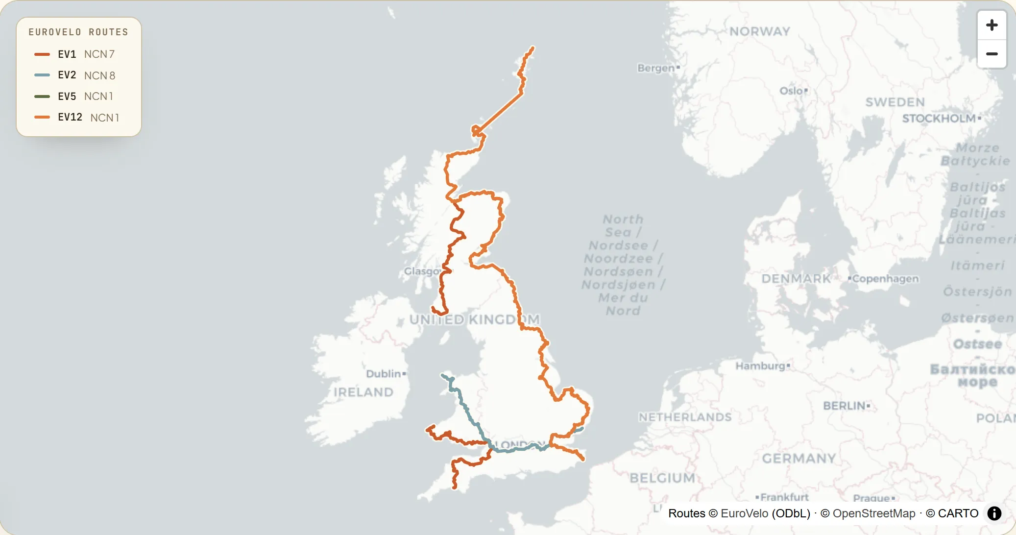
Map of Great Britain with four signed EuroVelo routes — the North Sea Cycle Route (EV12) hugging the whole east coast from Dover to the Shetland Islands, the Atlantic Coast Route (EV1) running the Scottish Highlands and the Devon and Wales south-west, the Capitals Route (EV2) on a diagonal from Holyhead to Harwich, and the short Via Romea (EV5) from Canterbury to Dover.
4
national routes
~5,300 km
EuroVelo signed
16,000+ mi
NCN, ⅓ car-free
Why United Kingdom

Four EuroVelos on the National Cycle Network.

Every UK EuroVelo rides the National Cycle Network — 16,000+ miles of signed routes, about a third traffic-free, built from former railways, canal towpaths and new paths through parks and cities, managed by the charity Sustrans. The scenery spans the Cairngorms and Loch Lomond, the Snowdonia and Brecon Beacons mountains of Wales, Bath's Georgian crescents, the Kentish lanes to the White Cliffs of Dover, and the Norfolk and Northumberland coasts out to the Orkney and Shetland Islands.

The mapHover a route to trace it

Four EuroVelos across Great Britain.

The UK's four signed EuroVelos, clipped from the official GPX tracks. Hover a line or its legend entry to trace it — the Atlantic Coast through the Highlands and Wales, the Capitals Route over Snowdonia, the short Via Romea to Dover and the North Sea Route to Shetland — then tap through to the route.

Interactive map loads as you scroll
National & regional infoBackground, not booking

The bodies behind the network.

The UK has one national cycling body — Sustrans — running the National Cycle Network behind every EuroVelo here, with Ordnance Survey supplying the maps. It's here for context and credibility. No need to leave to plan: your route and every place to stay come together in the Bikepackia planner.

The routesTap a card to learn more

Four ways through Great Britain.

Eilean Donan Castle, Dornie, in the Scottish Highlands
Photo: Ilya Ilyukhin / Wikimedia Commons (CC0)

Atlantic Coast Route

NCN 7ABERDEENFISHGUARD

The wildest and hilliest UK ride — a discontinuous Atlantic arc, signed across several NCN numbers. From Aberdeen it runs NCN 1 to Inverness, then the Lochs & Glens Way (NCN 7) past Loch Lomond to Glasgow, before the steep Devon Coast-to-Coast (NCN 27) in the south-west and the Celtic Trail (NCN 4 & 47) across Pembrokeshire to Fishguard. Hard: the Cairngorms and Highlands, then the notoriously steep Devon and Pembrokeshire hills. The card covers the British legs; between them an Irish Sea ferry (Stena Line, Rosslare ↔ Fishguard) crosses to Ireland and back. EuroVelo states ~1,700 km across the UK.

1,700 km18–24 daysHard
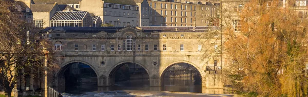
Pulteney Bridge and the weir on the Avon, Bath
Photo: Mike Peel / Wikimedia Commons (CC BY-SA 4.0)

Capitals Route

NCN 8HOLYHEADHARWICH

The Wales-to-London diagonal — signed the Lôn Las Cymru (NCN 8) over the Welsh mountains. From Holyhead on Anglesey it crosses Snowdonia (Eryri) and the Brecon Beacons to Cardiff — one of the UK's toughest signed end-to-ends — then the Severn, Georgian Bath and the Kennet & Avon (NCN 4) to Reading, the Thames through London (NCN 1 & 51) and out to Harwich. Hard for the sustained Welsh climbs; flat-to-rolling once over the Severn. The Holyhead end connects to the Dublin ferry, Harwich to the Hook of Holland. The ~850 km is a sourced sum of the Welsh (~400 km) and English (~466 km) legs, not an EuroVelo-published single figure.

850 km9–13 daysHard
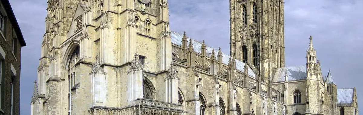
Canterbury Cathedral
Photo: Hans Musil / Wikimedia Commons (CC BY-SA 4.0)

Via Romea (Francigena)

NCN 1CANTERBURYDOVER

The network's smallest UK corridor — a short terminal leg on NCN 1, starting in the shadow of Canterbury Cathedral. Just ~46 km of gently rolling Kentish lanes (about 243 m of climbing) carry you through the countryside to the cross-Channel port at Dover and the White Cliffs. Easy: an afternoon's ride to the coast. From Dover the Via Romea continues to France on the Dover–Calais ferry, picking up the pilgrim road south through the Continent.

46 km1 daysEasy
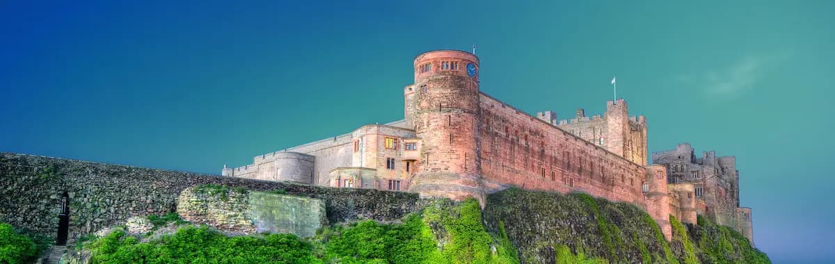
Bamburgh Castle on the Northumberland coast
Photo: Jeffpmcdonald / Wikimedia Commons (CC BY-SA 4.0)

North Sea Cycle Route

NCN 1DOVERLERWICK (SHETLAND)

The longest UK line and the network's longest single-country EV12 — the entire Great Britain east coast on NCN 1. From Dover it runs Harwich and Essex (a short NCN 51 link), Norfolk's Lord Nelson Way, the Boston–Lincoln traffic-free trail, Yorkshire, the Northumberland coast, Edinburgh, Dundee and Aberdeen, then John o' Groats and ferries off the mainland to Orkney and Shetland, finishing at Lerwick. Hard not for the terrain — the English east coast is largely flat — but for ~2,723 km of distance, North Sea headwinds, the hillier Scottish leg and seasonal island-ferry logistics. A multi-week expedition.

2,723 km30–40 daysHard
Before you rideThe UK, the practical bits

What every bikepacker asks about the UK.

Is wild camping allowed in the UK?

It depends on the nation. In Scotland it's legal — under the Land Reform (Scotland) Act 2003 and the Scottish Outdoor Access Code you may wild-camp on most unenclosed land, lightweight and leave-no-trace, away from buildings and roads; this covers the Scottish legs of EV1 and EV12, though seasonal byelaw zones apply (Loch Lomond & The Trossachs has permit areas roughly March–September). In England and Wales it's generally not — pitching without the landowner's permission is trespass, a civil matter, and the 'right to roam' covers walking and cycling, not camping. The one exception is Dartmoor, where a 2025 Supreme Court ruling confirmed a public right to backpack wild-camp in designated areas. Enclosed land, farmland, gardens and nature reserves are off-limits everywhere; in England and Wales plan on campsites or ask the landowner.

Which season is best for bikepacking the UK?

May to September, with June to August the warm peak and late May and September the sweet spot — mild, quieter and fewer midges. Summer highs sit around 18–23 °C in the England and Wales lowlands, cooler in the Scottish Highlands and on exposed coasts; spring and early autumn run about 10–15 °C. Rain is possible in any month, so pack waterproofs year-round, and the west (Wales, west Scotland) is wetter than the east. June gives the longest days — 16 to 17 hours of daylight in the far north. Avoid November to March for cold, short days and upland snow. Highland midges peak June to August, worst at dusk in still, damp air, so favour breezy coastal camps. EV12's far-northern island ferries are partly summer-only, making the Orkney and Shetland finish a late-spring-to-early-autumn objective.

Any cycling regulations I should know?

A few worth knowing. Helmets are not a legal requirement at any age, though the Highway Code recommends one, and a hi-vis vest isn't mandatory. Ride on the left — a real adjustment coming off the Continental EuroVelos. At night the law requires a lit white front lamp and a red rear lamp, plus a red rear reflector and amber pedal reflectors; flashing LED lights are legal and there's no daytime-light rule. There's no national headphone ban (it's discouraged), but riding on most pavements is prohibited and carries a Fixed Penalty Notice, typically around £30–£50, and 'careless' or 'dangerous' cycling and drink-cycling are offences. Cycle lanes aren't compulsory, and there's no points-on-licence system for cycling. Fine amounts are revised periodically, so treat them as a guide.

What should I expect as a bikepacker in the UK?

Four signed EuroVelos over Great Britain, all riding the National Cycle Network — 16,000+ signed miles, about a third traffic-free, built from ex-railways, canal towpaths and new park paths with the rest on quiet lanes, managed by Sustrans. Terrain ranges from the flat Norfolk and Lincolnshire coast on EV12 south to serious mountains — Snowdonia and the Brecon Beacons on EV2, the Cairngorms and Highlands on EV1. You ride on the left. There's no France-style paid cyclist-welcome label, but 'cyclists welcome' B&Bs and bunkhouses are common. Non-folding bikes travel free on trains, but most long-distance services need a free advance bike reservation with very limited spaces (often just two to four per train) and many peak-hour commuter services bar bikes entirely; folding bikes ride free anytime, and rules vary by operator, so book ahead — especially in Scotland and on the East Coast Main Line. EV12's far-northern islands need ferries, some summer-only. Resupply is good across England and Wales but thinner in the Scottish Highlands and the northern islands, so carry extra.

READY WHEN YOU ARE

Pick the route. We'll plan the rest.

Drop a EuroVelo into the Bikepackia planner and turn the line on the map into rideable days — surface-aware routing, elevation, water, food and a bed every night.