The route screen
Last verified
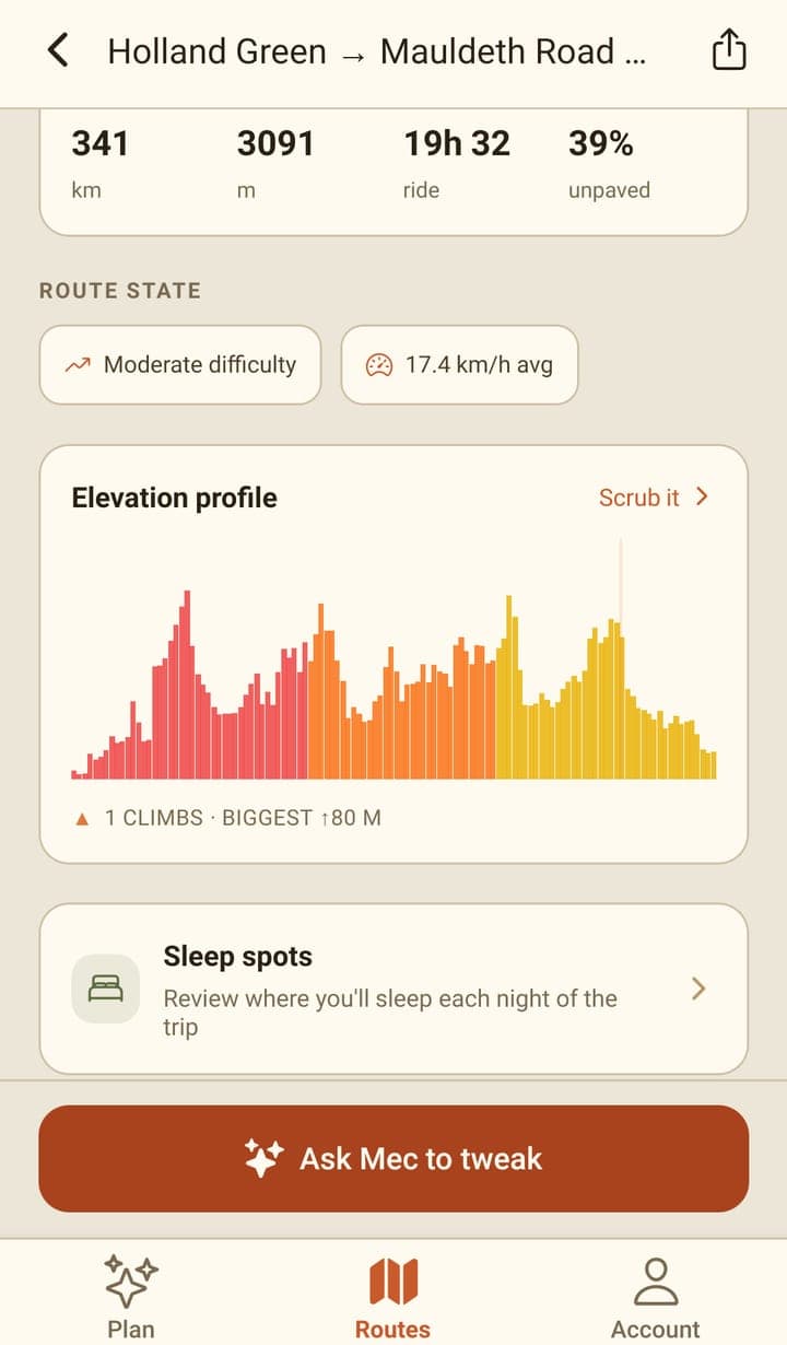
Opening a route shows the map above the trip's numbers: distance, climbing, ride time and how much is unpaved. Below sit an elevation preview, where you'll sleep, and the list of days. The share button exports the whole trip as GPX through your phone's share sheet. On a saved route, Mec, the AI route partner, stays out of the way until you tap 'Ask Mec to tweak'.
The numbers
| Figure | What it means |
|---|---|
| Dist | Total distance of the routed line. |
| Climb | Total metres of ascent. |
| Time | The routing engine's own estimate for the whole trip. |
| Surface | The share of the route that isn't sealed, when the data says so. |
| Difficulty | A plain label worked out from the climbing against the distance. |
| km/h avg | The average speed implied by the distance and the estimated time. |
The day-by-day screen shows a second, wider ride-time range for each day, which takes your bike and pace into account. The two are different estimates on purpose: one is the routing engine's, the other is shaped by how you ride.
The map
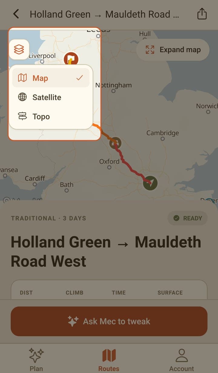
- Each day is drawn in its own colour, with a bed marker at the end of each one.
- The layers button swaps between Map, Satellite and Topo.
- Expand map opens the route full screen, where you can pan and zoom.
- A blue dot shows where you are, once you've allowed location access.
- Tapping a stop marker on the map at the top of the route screen opens its details.
Exporting GPX
The share icon in the header writes the whole trip as a GPX file and hands it to your phone's share sheet, so you can send it to a bike computer app, a cloud drive, or a message to yourself. Stops ride along as named waypoints. For now the app exports the whole route only; for one file per day, use the web planner.
Changing a saved route
A saved route opens read-only with an 'Ask Mec to tweak' button along the bottom. Tapping it opens the chat against that route. If you walk away with changes you haven't saved, the app stops you and asks whether to leave or keep editing.
Frequently asked questions
How do I get the route onto my Garmin or Wahoo?
Tap the share icon on the route screen and send the GPX file wherever you like — your device's companion app, a cloud drive or email. Bikepackia doesn't sync to devices directly (coming soon).
Why are there two different ride times?
The route screen shows the routing engine's estimate for the whole trip. The day-by-day screen shows a range per day that also accounts for your bike type and pace, so it's usually wider and slower.
Can I download a route to use offline?
Not yet. The Account tab lists offline maps as coming soon. Export the GPX before you set off and ride it from an app that holds maps offline.